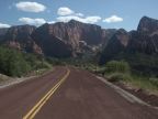
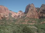
| The Cliffs of the Kolob Canyons rise above a curve in the Kolob Canyon Road. Beatty Point is the name of this particular outcropping, which is flanked by deep, narrow canyons on each side. |
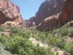
| The south fork of Taylor Creek flows out of this finger canyon, walled in on both sides and at it's end by high cliffs. |
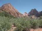
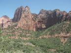
| Cliffs and domes of navaho sandstone rise above the desert vegetation of Kolob Canyons. |
| An especially skinny, deep canyon cuts straight into a dome peak in the Kolob Canyons area. |
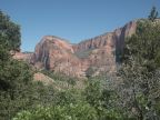
| Cliffs in the Kolob Canyons area, viewed from the La Verkin Creek Trail. |
| A trickle of water flows down the face of this cliff above the La Verkin Creek Trail. |
| Nugent Mesa rises 1,500 feet above the La Verkin Creek Trail to the right of this deep canyon. |
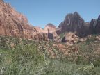
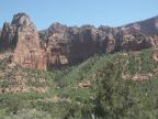
| Juniper trees frame this view of the Kolob Canyons. |